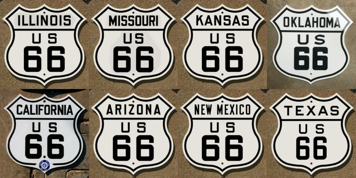
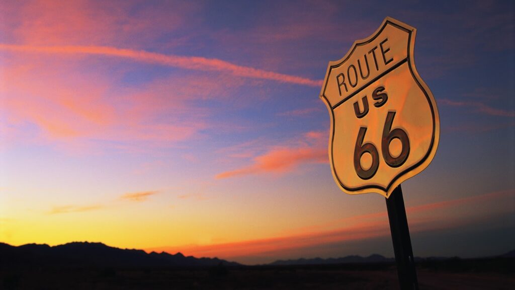
The Route 66 highway shield stands emblematically for America’s transformation to a fully mobile society. Established 100 years ago in November 1926, the 2448-mile historic highway of lore paved the way for both commerce and adventure, which in turn provided the economic lifeblood of American entrepreneurs who gassed, fed and sheltered them.
Demographic forces and a need for speed led to Interstate freeways that eclipsed the erstwhile major highway. Though decommissioned 40 years ago, the old road that once pulsed through the heart of America from Chicago to Los Angeles remains embedded in our consciousness.
Route 66’s story begins with the creation of the original national highway system and fate’s lending hand that gave it direction as well as its magical number, timeless song and maternal moniker. The independent businesses that attended to travelers along the way imbued the famed road with its unique character.
Road warriors still venture out on the extant sections of old Route 66 for a slow ride through small towns and adjacent views of our diverse geography, for a taste of Americana, and a deeper appreciation of our history. The road still proves both instructive and an enjoyable ride.
The Route’s Pathway and Numbering
In the early 1920’s, America’s disorganized hodgepodge roadways of rutted dirt, gravel trails and intermittent pavement were numerically designated in a haphazard fashion. Hence, the American Association of State Highway Officials drafted plans for a comprehensive network of highways with a uniform number system. Individual states in this inherently political game recognized that highways—like railroads before it—would prove economically transformative.
Oklahoma—originally designated as ‘Indian Territory’ and a state for less than 20 years—seemed an unlikely influencer in the planning process. Yet, Oklahoman Cyrus Avery convinced the Association that an established trade route existed from Chicago to St. Louis, then on to Tulsa via the Frisco Railroad. From there, Avery drew a line west to California, a long road that warranted designation with a coveted round number 60 that signified a major highway.
Predictably, competing representatives for the planned east-west highway running from Virginia to Los Angeles also wanted number 60. Avery’s group dropped the bid for the round number so long as the proposed highway from Chicago to Los Angeles ran through Oklahoma. The Association designated the planned highway with a compromise number: Voila! Route 66.
Thus, the new highway assumed an alliterative double number that pleasingly rolls off the tongue—rhythmic with an ending ‘x’ that gives it kick. In numerology, sixty-six stands for optimism and idealism. Visually, the double six framed within the its’ highway shield looks ‘cool’.
Beginning near the edge of Lake Michigan in Chicago, the road would run south through Illinois’ bountiful cornfields; then bridge the Mississippi River to old St. Lou where the highway veered in a southwesterly diagonal over Missouri’s Ozarks undulating woodlands to Oklahoma, biting off the southeast corner of Kansas along the way. From there, a forward ho! due west over the Great Plains and arid steppes of the Texas panhandle followed by an enchanted run through New Mexico with an up and over the continental divide to Arizona’s painted desert and high country. The roadway then crossed the Colorado River, followed by an arid run across the sun baked Mojave Desert to dreamland LA, terminating at Santa Monica at the Pacific Ocean shoreline.
Constructing a Pioneer Road.
Drawing maps for highways and constructing them differ like pipe dreams and deeds. To kick start construction, the Federal government provided matching highway funding with states making up the balance and maintaining discretion regarding roadway priorities. Thus, individual states completed Route 66 in piecemeal fashion, with permutations and re-routing as the route evolved. Pre-existing paved roads were incorporated into 66, and by-passed later when a new stretch of road was constructed.
Like builders of the Transcontinental Railroad who laid track quickly and upgraded later, contractors graded roadbeds, with actual pavement and bridges in many places coming later. In the early years, hard pack rutted dirt trails and gravel roads described vast sections of the emerging federal highway.
By the late 1920s, Illinois linked existing roadways for a paved way for Route 66. Missouri completed its southwest diagonal of Route 66 by 1931. Meanwhile, California paved the west end of the highway though haste required improvements as the 15-foot width proved too narrow, its 4-inch bed too thin to carry traffic long term.
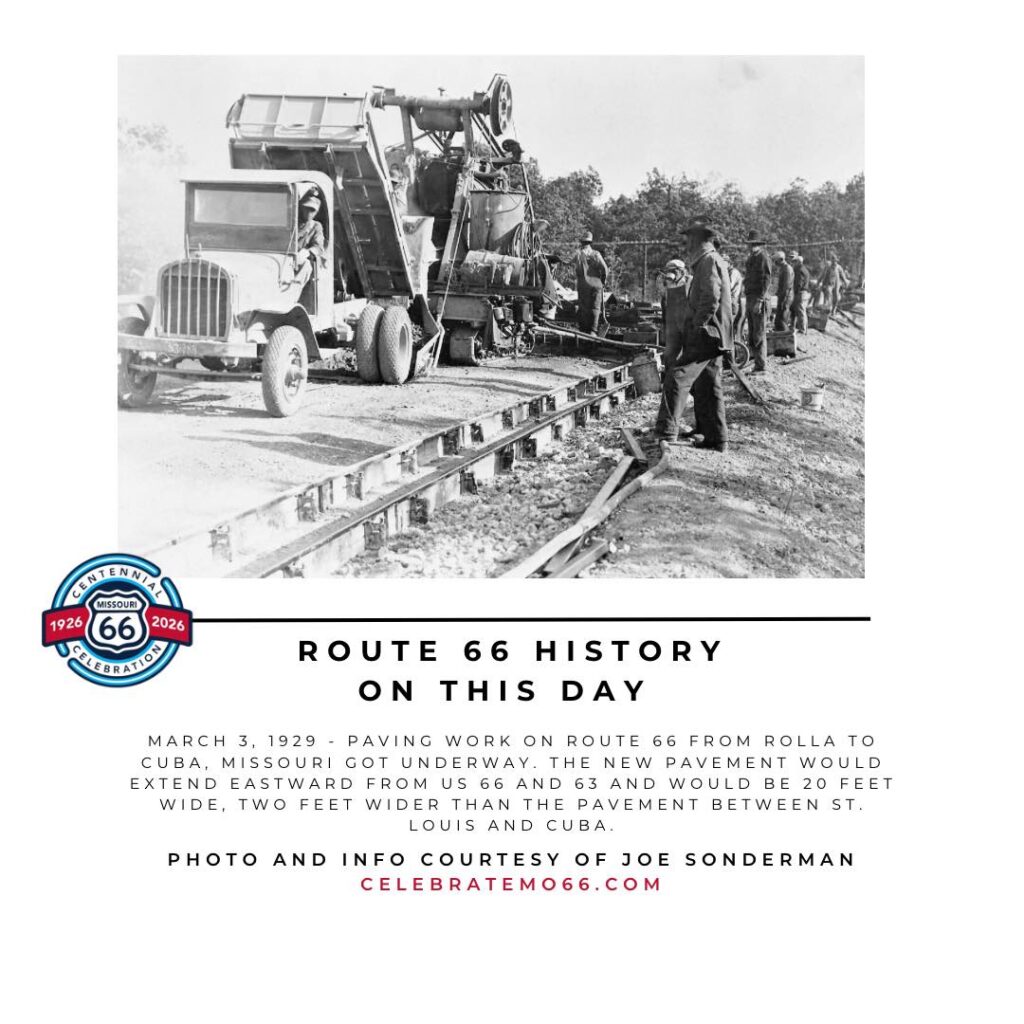
Kansas wanted a piece of the road and the money and jobs that came with it. The Jayhawks paved its stretch of highway in 1929, though no great achievement given the roadway’s foray into the Sunflower State ran a mere 13 miles. Progress proved slow in the vacant West. Mules and horses employed log dragging to grade much of the land. The highway was finally paved from end to end in 1938.
Kindred spirits of pioneers of yore, early roadsters undertook an uncertain peregrination on cars oft driven over gravel, clay, or hard pack for long, lonely stretches.. Rain turned the rutted road into gumbo. Bridges took longer and cost more to build so contractors graded over low spots in creeks and washes of New Mexico and Arizona. If water covered these ‘dips’ in the road, green horn drivers—who would have been alright if they waded through low water—instead veered around it, often getting stuck in quicksand. No AAA to call in those days. Of course, no cell phones to call for help either. In fact, there might not be a phone for miles.
Automobiles proved problematic. Radiators overheated in hot weather; belts broke, and motors blew. No steel-belted tires so flats proved common. Frustrated travelers repaired cars and patched innertubes on the spot. A driver in those days was not only hardy but handy as well.
Despite travel travails, Route 66 was promoted from the outset by those who hoped to profit from eager travelers even though the road was only graded to a semblance of a highway in many stretches. Charles Pyle staged a 3400-mile Great Transcontinental Foot Race, via Route 66 from Los Angeles to Chicago, then on to New York. Dubbed the Bunion Derby, the race attracted 274 runners and a media caravan that dispatched radio broadcasts, filmed newsreels, and penned stories of the event as it passed through towns.
Oklahoman part Cherokee Andrew Payne won the ultra-marathon with a time of 573 hours. He invested his winnings into a family home where oil was later discovered, which perhaps reflected Route 66’s early karmic powers.
Indeed, Route 66 achieved notoriety from its earliest days when promoted as the road to the 1932 Olympics in Los Angeles. Because its path ran through the center of towns along the way, promoters called it the Main Street of America.
Moniker and Music.
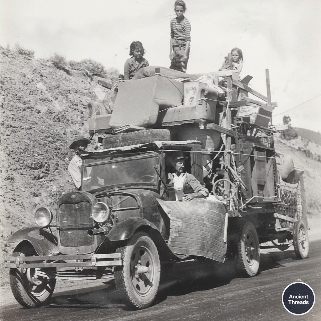
The Depression and the Great Plains dust bowl shook America to its core. Destitute Americans loaded their meager possessions of tent bedding, chairs and luggage atop their vehicles or strapped along the sides and rears of their rattling jalopies and headed west to California’s presumed promised land. John Steinbeck deemed Route 66 the “Mother Road” in The Grapes of Wrath, a classic novel about those who traveled west in search of a new life.
Sixty-Six is the path of people in flight, refugees from dust and shrinking land, from the thunder of tractors and shrinking ownership, from the desert’s slow northward invasion, from the twisting winds that howl up out of Texas, from the floods that bring no richness to the land and steal what little richness is there. From all of these the people are in flight, and they come into 66 from the tributary side roads, from wagon tracks and the rutted country roads. 66 is the mother road, the road of flight.
Gas rationing slowed traffic during World War II, but military goods, ordnance and troop movements kept Route 66 kicking. The massive atomic plant in Los Alamos was a hundred miles south of the Mother Road. Soldiers needed transport to Fort Leonard Wood in rural Missouri. People seeking work traveled Route 66 to California’s defense plants that equipped U.S. forces during the war in the Pacific.
The Mother Road’s legend grew after the War. The economy boomed for the middle class who enjoyed disposable income, reliable cars and inexpensive gasoline. Route 66 paved the way for memorable road trips to the wide-open West with dreamland California at the end of the rainbow as vacationers followed Horace Greeley’s call: “Go West, young man, go West.”
Bobby Troup’s lilting tune (Get your Kicks on) Route 66 with its rhythmic litany of towns along the way captured America’s imagination. The song clicked for both listeners and the scores of jazz, country and rhythm and blues musicians who covered it:
If you ever plan to motor west
Travel my way, take the highway that is best
Get your kicks on Route Sixty-six
It winds from Chicago to LA
More than two thousand miles all the way
Get your kicks on Route sixty-six

Now you go through Saint Looey
Joplin, Missouri
And Oklahoma City is mighty pretty
You see Amarillo
Gallup, New Mexico
Flagstaff, Arizona
Don’t forget Winona
Kingman, Barstow, San Bernadino

Won’t you get hip to this timely tip
When you make that California trip                                                               Get your kicks on Route sixty-six…..
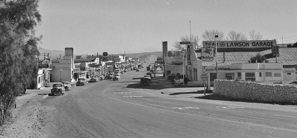
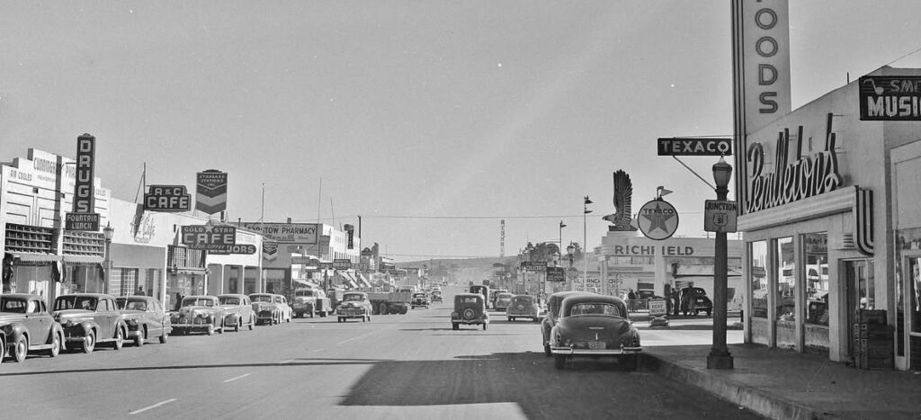
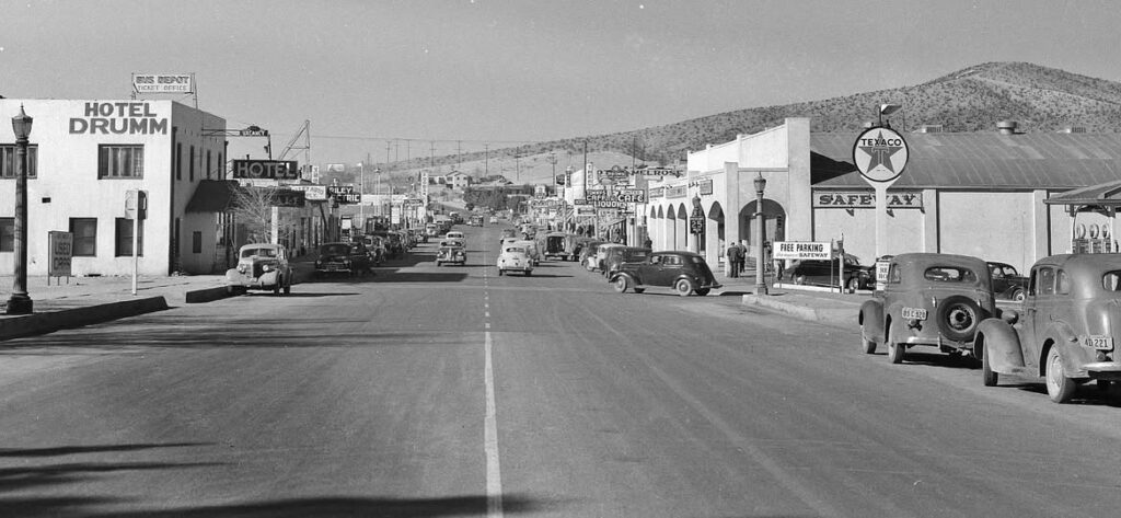
The Great American Road trip merged the American ethos—life, liberty and the pursuit of happiness—both for those on the road and the enterprises created to serve them. Indeed, the Mother Road proved mother’s milk for the proprietors of gas stations, motels, cafes and trading posts that thrived along 66’s length, built from scratch by folks who worked long hours to create successful businesses.
Entrepreneurs
Cars went nowhere without the gas stations that sprang up like springtime mushrooms. Between 1920 and 1930 alone, the number of gas stations in the United States increased from approximately 15,000 to approximately 124,000. Small town station owners began with a small hut and two service pumps, later adding tire sales and service bays for repairs to augment their small business revenues.[i]
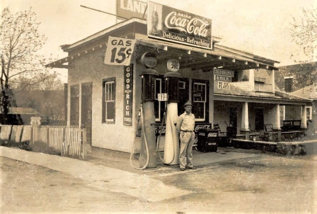
Susan Croce Kelly’s book—Route 66—provides detailed examples of entrepreneurs who saw opportunity and put their shoulder to the wheel for those behind the wheel. Self-made businesses in the purest sense existed free of corporate franchise mandates and homogenized store fronts, which gave ‘America’s Main Street’ its ever-changing aspect.
Those departing from Chicago on 66 did not have long to wait for a memorable stop. Outside of Joliet, Charlie Reed’s painted his Welco Truck Stop building with a variety of bright colors with depictions of large black angus bulls holding down the four corners of the roof. Inside, action pictures of Reed’s rodeo bravado greeted truckers’ along with a café, lounge, barber shop and sleeping rooms.
Lester Dill promoted Meramec Caverns nestled in Missouri’s rustic Ozarks along the river of the same name, located a short drive off the highway. Dill arranged to paint barns located along roads from Texas to Ohio free of charge if the barn could be painted with large white lettering on the side that faced passing traffic: See Meramec Caverns Route 66 Mo. Dill promoted the cave as Jessie James’ hideout. Never mind that Jessie looted banks on the opposite end of Missouri, and his gang would have ridden 200 miles by horse to “hide”. Concocted stories of gold coins and empty old Wells Fargo bags purportedly found inside the cave’s so-called “Loot Rock” bolstered the myth. As was said: “If you see Dill’s mouth moving—he’s either eating or lying.” But his promotions worked; tourists flooded the Caverns with cash.
Early lodging proved as basic as the newly created highway, both of which improved over time. Initially, travelers were happy for a roof over their heads with outdoor privies. In the early days, Lois and Emis Spears accommodated lodgers by renting tents. Indoor plumbing and fresh linens came later when the motor court business evolved to keep pace with a more affluent public.
Jessie and Pete Hudson opened the original Munger Moss Motel as a modest stopover located near Devil’s Elbow so called due to a precarious tight turn coming out of a steep grade of the Ozark Hills. When the highway department bypassed the dangerous curve, the Hudsons moved their motel to nearby Lebanon. The motor court grew to 71 units with an outdoor swimming pool for guests, the latter becoming a standard requirement for traveling families who needed a place for wound-up children to expend vent up energy after car sitting for hours.
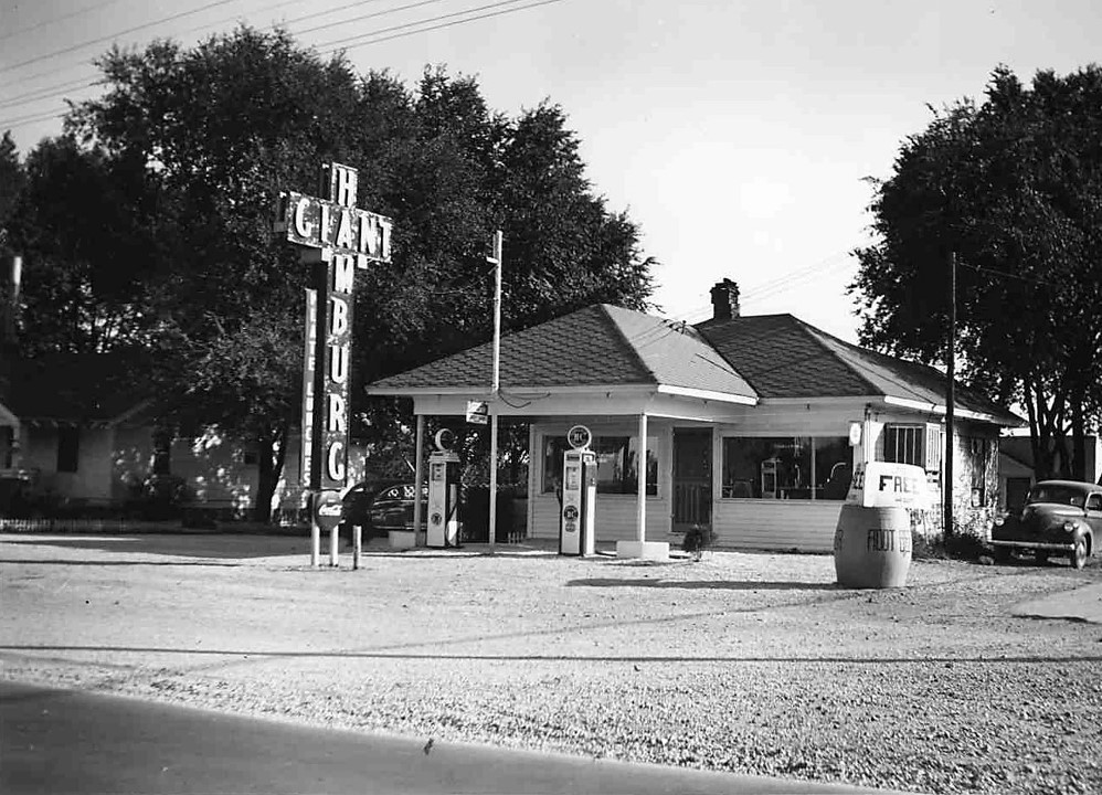
In Springfield, Sheldon ‘Red’ Chaney opened his hamburger stand in a re-converted gas station named Red’s Giant Hamburg, his sign hawking the hungry with a giant cross with the word Giant running left to right on the cross arm, and Hamburg running down the shaft, with the “A” of each word in the middle. Red hung outside speakers to take orders straight from the driver’s seat for those anxious to burger up and go.
The Kays opened a Buffalo Ranch in Afton, Oklahoma. The noble beast all but disappeared from our landscape so the chance to see real live buffalo proved irresistible. The Ranch later added llamas, elk, deer and exotic chickens, rabbits, sheep and goats. The view was free; the adjoining trading post that sold western wear, moccasins, Indian jewelry and souvenirs were not. An ice cream stand and a barbecue restaurant followed.
John Nunn built Tower Station in Shamrock Texas in 1936 at the intersection of Routes 66 and 83 from plans first written in the dust. LeeWay Trucking utilized the junction as a waystation for the company to change drivers. Roy Clines opened a corner café and gas station 50 miles west of Santa Rosa at the ‘coldest, meanest and windiest place’ on Route 66 in what some called “Nowhere” New Mexico. When the highway was rerouted, Cline jacked up the station and hauled it to the new roadway.
“Cars kept coming…In summers, it would be almost like a….city boulevard” noted Beatrice Boyd who with husband owned a gas station as well as the Caravan Inn in Arizona with 16 units at a cost of one dollar a night.
Travelers craved western souvenirs that memorialized the trip and served as bragging rights about their visits that others only saw on their black and white screen televisions. Indian crafts, rugs, pottery, cowboy hats, rocks, and hand-made Navajo jewelry sold quickly.
Leroy Atkinson opened Box Canyon Trading Post near the arid New Mexico-Arizona state line where his initial offerings to attract customers in a desert environ seems quaint today: water; outside restrooms and a café. Atkinson promoted his Post with Indian Dancers, buffaloes, and giant prehistoric figures to entice travelers. Tobe Turpen’s trading post included a reptile garden, along with pseudo-Indian ruins and buffalo to attract the curious to see working displays of silversmiths and Native American weavers whose crafts were for sale.
Businesses erected structures and signs to attract customers—ranging from 30-foot-tall double arrows angled into the ground to mark the spot, to faux teepees and cavalry forts. Gimmicks proved essential. Kitsch was Kool.
A series of roadside signs promoted the Jackrabbit. Approaching drivers could not miss the hand-built large sign that proclaimed: “Here It Is.” A composition jackrabbit crouched at the gate of the whitewashed building decorated with murals of cacti and ‘Injuns’ that beckoned tourists to buy curios, Indian crafts and rugs, pottery, hats, souvenirs, and hand-made jewelry along with the cash cow trilogy: gas, liquor and food.
Loren and Mildred Armes owned and operated Cardy’s Camp in Needles, California. Their gas station filled tanks; their sandwiches filled gullets; their novelties filled imaginations. It was the last stop before the desert. “We’d check radiators and sold desert bags (canvas bags filled with water) to keep folks hydrated.”
The desert road offered no guarantees. Halfway across the Mojave Desert, Buster Burris opened a service station to deal with distressed motorists who lined up outside his garage for mechanical help, which often occurred when the ambient air registered 120 degrees that amped the surface of the road to an egg-frying 140. Many vehicles overheated. “It was like driving across a stove” quipped Burris who expanded his business with a café, motel rooms, and wrecker service.
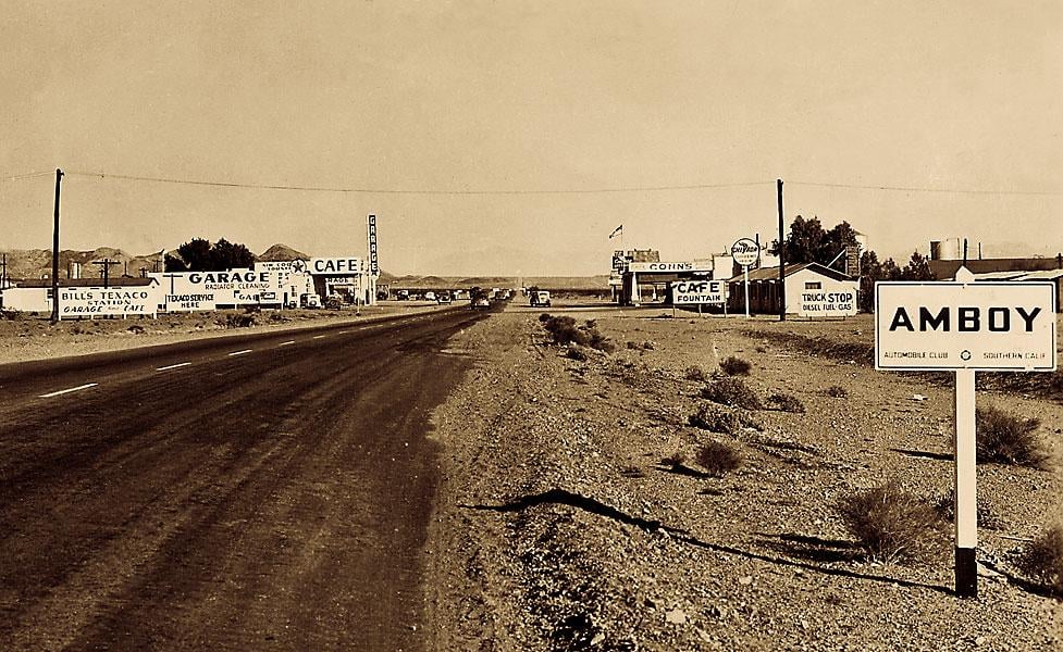
Businesses on Route 66’s periphery kept cars gassed and folks fed, bedded, and stockpiled with curios. Location and promotion served as their creed. Ironically, the sheer numbers of vehicles that boomed business outgrew the highway. Ultimately, time bypassed Route 66 businesses like the vacuum whoosh of a Freightliner speeding down the Interstate.
End of an Era.
Time marches forward to the beat of an unknown drummer, the pied piper’s echoing tune we follow. In 1926, America mapped a unified highway system for the drivers of Tin Lizzies coming off the assembly line who wanted to roll across the country. Smaller cars moved slower, the population and especially the number of cars on the road fewer.
Back then, the U.S. Census Bureau numbered Americans at 117 million; by 1986, that number increased to 240 million. Today, the Bureau estimates U.S. population to be over 340 million. The number of vehicles accelerated even faster than the population:
Year Passenger Cars Large Commerce Trucks 1926: 19,268,000 2,932,000 1986: 130,000,000 45,000,000
Eventually, the road proved too slow and too dangerous for the exponential increase of cars with high powered V-8 engines crowding the road. Places along Route 66—designed for an earlier time—contained dangerous stretches with infamous names for two-lane killers like Devil’s Elbow in Missouri, Dead Man’s Curve in New Mexico, and Camino de la Muerte in Arizona, that put wreckers to work and roadsters to hospitals and morgues. Higher speeds and safety mandated limited access, four-lane divided highways.
The 1956 Federal Highway Act established the Interstate highway system that presaged Route 66’s demise, although it took 30 years after enactment to completely by-pass America’s Main Street, more than double the 12 years to entirely pave Route 66. The slab-by-slab interstate construction acted as a concrete block that sank existing businesses along the old roadway.
Interstate 55 subsumed Route 66’s run from Chicago to St. Louis; I-44 usurped the Mother Road’s southwest run from old St. Lou to Oklahoma City. I-40 allowed drivers to haul across the Texas panhandle, New Mexico and Arizona; Interstates 15 and 10 funneled travelers into California and the Los Angeles’ traffic nightmare. The Interstates cut the drive time from Chicago to Los Angeles by 40 percent but left businesses that lined Route 66 in the interstate’s exhaust fumes.
The people who once made their livelihood along the Mother Road bore the cost of progress. “This road here doesn’t have no name anymore. It’s just a paved piece of road. Old 66—that’s just the last name it had, just old 66,’ said Russell Soulsby of the family-owned Shell Station for 60 years in Mount Olive IL, by-passed by I-55. Leon and Ann Little of Hinton Oklahoma, saw their business evaporate when the Interstate by-passed them: “[T]he day the traffic moved, well that was it.” Many businesses went from full house to poor house.
By 1985, only one section of the old road remained a part of the national highway in Williams, Arizona. The crowd cheered when (Get Your Kicks on) Route 66 composer Bobby Troup cut the ribbon that both symbolized the opening of the last stretch of interstate and the end of Route 66 as a part of our national highway system. Troup could not help himself when he admonished the throng: “I don’t know why you’re cheering; this is an end of an era.”
When the crowd dispersed, many exited onto the Interstate, leaving behind a ghost highway, a memory mirage floating above the old road as seen from afar.
The Interstate.
Engineers designed Interstate highways in a vain attempt to keep pace with traffic. Cities commonly shoulder four lanes in each direction to carry harried commuters who bear game faces when negotiating the stream of traffic.
The open road shrinks as cities expand into the hinterlands supplanting forests and farmland with a suburban sprawl of homes and three-car garages where vehicles sit poised to add to the congestion. Highways connecting metropolises carry multiple lanes of traffic where cars and seismic semis race at 80 MPH in a competitive race to the next stack of vehicles that mock the idea of the open road. Maintaining maximum speed and position remain paramount. Expressways exist as a means to an end where commercialized landscapes reign supreme.
George Carlin’s cut to the bone of American life with his rift on our consumerism (abbreviated here):
It seems to me that only a really low IQ population could have taken this…magnificent American landscape…and turned into what it is today, a shopping mall.
Mile and mile of mall after mall…They put the mini malls in between the major malls. And in between the mini malls they put the mini marts. And in between the mini marts you’ve got the car lots, gas stations, muffler shops, laundromats, cheap hotels, fast food joints, strip clubs and dirty book stores. America the beautiful. One big transcontinental commercial cesspool.
Billboards blight our view. At night, commercial icons emit enough candlepower to illuminate a small town in their 24/7 quest for a place in our pockets. Of course, Route 66 businesses erected billboards to snare tourists, but their signs stood close to the ground with reasonable dimensions. Compare today’s behemoths on steroids—double the size, perched atop 60-foot metal monopoles—that hawk everything from injury lawyers to dog food.
Travelogue commentator Charles Kuralt once remarked that “Thanks to the interstate highway system, it is now possible to travel across the country from coast to coast without seeing anything.” Given the clutter and congestion along our interstates, is it any wonder that some seek refuge from the commercial barrage via an old-fashioned road trip along Route 66?
The Interstate
our destined fate
with frenzied pace
to destined place
Its mile wide swath
what’s there to watch billboards and chains
sellers’ domain
Homogeneous
monotonous
what has been seen
what does it mean
So time was saved
as we all raved
but something’s lost
what was the cost
Our lives speed by
blink of an eye
want to slow down Sixty-Six bound.
Escape to a Road Less Traveled.
Old school roadsters exit the Interstate to a road less traveled in search of something new via something old aboard Route 66. Time travelers on a two-lane odyssey seek yesterday’s holy grail, a mirage of bygone times when America existed as a nation of regional towns and dialects, where chains were used to drive on snowy roads rather than the ubiquitous national hotel and restaurant chains that devoured mom and pop businesses.
These road trippers do not want to make time, but to take time. The ultimate destination remains an afterthought. Their quest to experience history and Americana has bestowed life after death for the Mother Road.
Approximately 85 percent of the old road remains extant. Navigation required as Route 66 now exists in various incarnations. Disjointed in parts, some sections were incorporated into the Interstate itself. Other times, the one-time thoroughfare appears incognito where it parallels the interstate as a seemingly mere service road.
Thankfully, the old roadway often drifts away from the Interstate’s roar of giant semis, vying vehicular traffic and the dark shadow of massive billboards. During these many long jaunts, the Mother Road’s apparition takes form as a wondrous two-lane traverses out of sight and sound of the super slab expressway. Those two-lane runs into the countryside differ from the Interstate’s construct that scoured the land with broad swaths of concrete and uniformity with long sight lines and four-way limited access interchanges needed to accommodate high speed traffic.
Conversely, engineers designed Route 66’s pathway that more closely followed the terrain’s contours rather bulldozing straight through it. Cruising the old road feels more in tune with the land rather than zooming on past it. A shrinking commodity in our expanding national community, two-lane backcountry roadways uninterrupted by commercial call and competitive traffic close out negative thoughts and offer a blank slate on which to sketch a fresh perspective. Open stretches of extant 66 infuse a road trip with introspection in a way that no Interstate ever could.
Much of these isolated runs of old roadway consist of limited local traffic. The Mother Road requires a drop in speed to 30 per through towns as the mind speeds up to absorb scenes where time slows down. Something intangible exists on a quiet two-laner, billboards and national chain stores conspicuous by their absence.
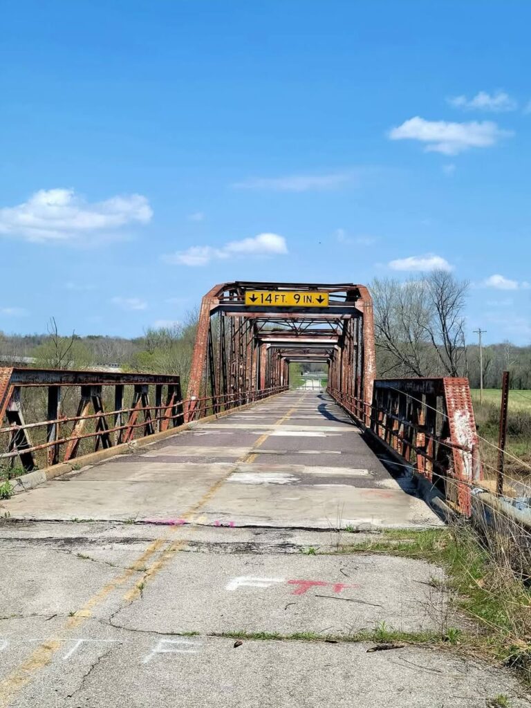
An escape to old Route 66’s slow pace roll along offers a glimpse inside small towns and an adjacent view of America’s farms, wooded hills, open ranges, mountains and deserts. Vintage roadside motels, antiquated gas stations, steel truss bridges, ruins of bygone businesses, kitsch and the curious appear as historical markers along the way.
A Modern Old Road Odyssey.
At nearly 2500 miles, a journey on old Route 66 requires time, patience and resistance to the magnetic pull of modern life that spurs acceleration. Traversing the slow road through towns with stops for sights along the way should take ten or more leisurely days, consecutively or in piecemeal fashion.
No longer a straight ahead roadway, the Mother Road requires attentive mapping. Jerry McClanahan’s EZ-66 Guide—filled with fine hand-drawn sketches of roadside scenes—aids in navigation and alerts sightseers of the myriad of places, things and scenes to view along the way
The following random roadside descriptives highlight what could be called ‘postcards from the edge’ of Route 66. A complete listing would require a tome.
Illinois
Route 66 originates in downtown Chicago. The massive footprint of Greater Chicagoland subsumed any semblance of the old road now congested with vehicles and traffic lights, which if traversed would consume exasperating hours to reach Joliet.
Route 66 asserts its identity south of Chicago’s suburban sprawl and Interstate 55’s shadow near Wilmington where the Gemini Giant greets 66-time travelers. Named after the 1960’s space program, the 30-foot-tall green suited giant sports an astronaut’s helmet that more resembles a welding mask and cradles a ‘silver rocket ship’ in its hands. Like many oddities along the way, Gemini Giant acted as a prop to attract travelers to nosh at the Launching Pad. It now stands guard over a quiet town and serves as an appropriate launch down the Mother Road.
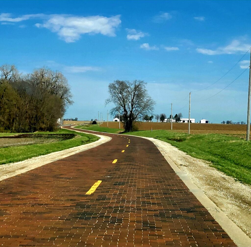
Beyond Wilmington, old 66’s two-lane path follows in and out of I-55’s shadow with long stretches out of view of the super slab as it makes its way through main streets of old railroad towns that predate paved highways with extant architecture to prove it. Ahead beckons Dwight with its eye-catching Chicago and Alton Railroad depot built in 1891, and Ambler’s historic Texaco station circa 1933 opposite the Old Route 66 Family Restaurant filled with bygone photographs and memorabilia Founded in 1837 and named for a famed Native American, Pontiac serves as the seat of Livingston County. A pleasing town square circles the courthouse. The handsome turn of the century Romanesque Revival style city hall neighbors the Route 66 Hall of Fame Museum replete with artifacts from the Mother Road’s role as a mover of people and product.
On the road again, travelers roll by the 1932 Standard Oil station constructed in the house and canopy style typical of the times. Period gas pumps stand sentinel along with an attached garage with work bays and tools of the trade. The Village of Odell restored and man this classic station now included in the Register of Historic Places.
Route 66 continues south with its peak-a-boo with I-55, paralleling it, then losing contact, crossing over it at intervals, but primarily rolling 0n quiet two-lane stretches along Illinois’ corn fields and small towns along the way until it approaches Bloomington, a city with 19th century buildings and homes designated as National Landmarks.
Down the road looms Springfield, the Illinois State capital. Completed in 1888, the French Renaissance and Italianate style capitol building stands as the nation’s tallest with a height of 361 feet. But Abraham Lincoln’s home and presidential museum—and the circa 1853 predecessor capitol building where Lincoln delivered his House Divided speech—serve as favored attractions. Upon departing his adopted home to assume the presidency in 1861, Lincoln prophetically addressed townsmen stating: “I now leave, not knowing when, or whether ever, I may return, with a task before me greater than that which rested upon Washington.”
Travelers departing Springfield may follow the more direct line that parallels the interstate, or opt for the scenic route to charming Carlinville via Highway 4 but linked as part of the original Route 66 from 1926 to 1937. The old road wends its way south through small town Staunton and prosperous Edwardsville continuing west where it crossed the Mississippi River.
Missouri
The mile-long steel girded truss Chain of Rocks Bridge opened in 1929. The bridge bends at a unique 22 degree turn midstream to allay river pilots’ concerns about maneuvering around two adjacent water intake towers. Later deemed too narrow for modern traffic, the bridge closed to auto passage years ago. Only a steep drop in scrap steel prices saved the bridge from demolition in 1975.
Thankfully, the bridge remains open to pedestrians and bicyclists. Standing 60 feet above the river, the bridge affords a stunning view of the mighty Mississippi, and the two historic water pumping stations—the first built in 1894 in a Romanesque style, the second in a Roman villa style in 1915. The downstream scene includes the river flow over the ‘chain of rocks’, Mosenthein Island, and the graceful 630-foot-tall St. Louis Arch looming in the distance.
Maps show the varied paths the old highway took through old St. Lou. None are recommended unless one enjoys idling in traffic. The loss of the famed Coral Courts—a 1940’s art deco style with glazed ceramic brick, rounded bays, and glass block windows—underscores our culture’s penchant to sweep historic architecture into waste bins. The National Trust for Historic Preservation and Preserve Route 66 seek to protect endangered historic structures along 66.
Clear sailing begins anew at Pacific, a town beyond urban sprawl now lapping near its shores. From here, Route 66 follows an old and new symbiotic highway relationship through Missouri, sometimes paralleling I-44 but more often escaping the interstate’s shadow, cutting through the Ozarks’ hill and dale of forest and fields.
In Cuba, the old road backends the town where the 90-year-old Wagon Wheel offers rustic rock-ribbed cabins for lodgers. The old road continues its interstate independence where it eases between the 90-foot rock-walled Hooker Pass, then past Devil’s Elbow bridge that spans the Piney River under the shadow of tall bluffs. St. Robert features a wondrous Neon Park with eight classic neon signs saved from vacated Route 66 businesses. The eye-pleasing neon emits a seductive quality with 360 degrees of light that can be shaped and styled with twists and turns that sterile LED light cannot.
Just past Springfield, Route 66 re-asserts its two-lane independence north of the interstate for a 50-mile run of free wheeling. Along the way, the road drops down to a steel girded bridge spanning Johnson Creek and enters the ghost town of Spencer. One hundred years prior, Sydney Casey ‘purchased’ the town anticipating that the future highway would follow the old stagecoach trail. Restored buildings from that bygone era include a barber shop, store, café and gas station.
Carthage might be the best Missouri Mother Road stop. The town prospered due to the wealth created by surrounding zinc, lead, and limestone mines. Locals put that wealth to good use when they built beautiful 19th century homes there. In 1895, the prosperous locals completed the marvelous Jasper County Courthouse. Constructed with pearly grey Carthage marble, the courthouse appears almost white when illuminated at night.
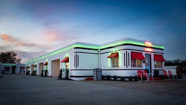
Boots Court locates northwest of the town square. Arthur Boots designed his 1939 motel in a Streamline architectural style. Clark Gable ‘slept here’—not once, but twice. Like others similarly situated, the Boots suffered when the Interstate by-passed the town taking the tourist trade with it. The classic motel miraculously dodged the wrecking ball when local preservationists restored the Boots to its original glory. The illuminated Boots Court sign beckons travelers along the Mother Road to lodge in neat, cozy rooms and to sit outside in the courtyard beneath the pleasing neon that wraps around the motel’s white exterior.
Kansas
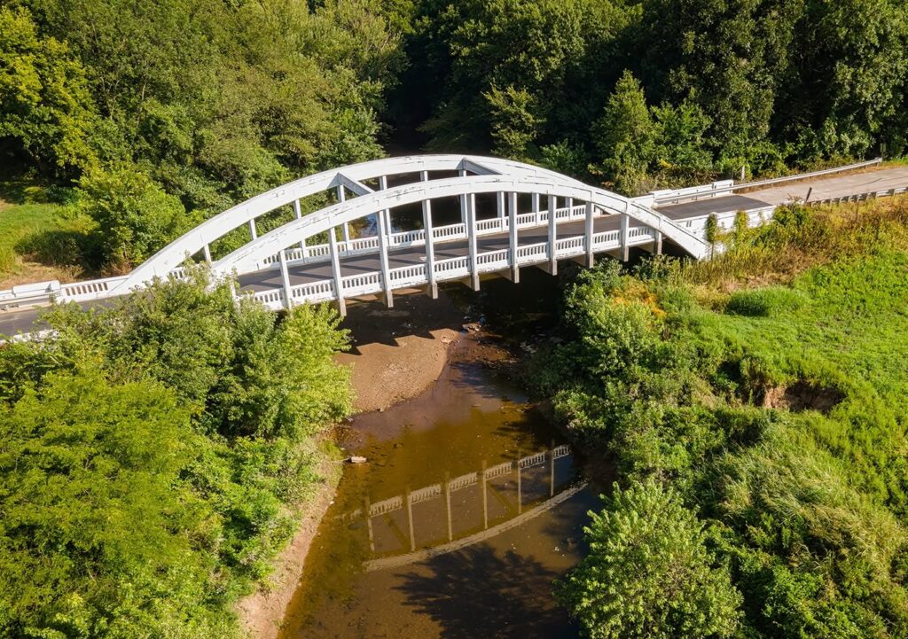
The road west crosses the Kansas state line for 13 miles of smiles beginning with Galena’s restored retro gas stations. The road then leads to the 1923 double-truss Rainbow bridge recently sandblasted and freshly painted. In Baxter Springs, the 1930 Phillips 66 station hosts a gift shop where the storekeeper regales customers and amazes them when he turns his two feet opposite, one pointing west, the other east—ala Route 66 where some travel west, others east.
Oklahoma
Route 66 remains more than OK in Oklahoma where it retains much of its identity across its 432-mile course. The one-time Main Street of America traverses through small towns, passing by an impressive statue of hometown hero Mickey Mantle, a/k/a the Commerce Comet along the way.
Next up the photogenic Blue Whale, constructed in the early 1970’s by Hugh Davis as a gift to his wife Zelta who collected whale figurines. Standing 20 feet tall and 80 feet long astride a small pond, the behemoth sports a tiny cap and a large smile to swallow visitors ala Jonah who enter his gaping maw.
The Will Rogers Museum and Home stand out as the best attraction of this northeast leg of the Oklahoma roadway. Part Cherokee, Rogers was a lassoing cowboy extraordinaire who gained fame in a rodeo show in New York when an angry bull hopped the fence and entered the stands filled with terrorized city slickers. Rogers boarded his horse, jumped the fence, and lassoed the bull thereby gaining east coast headlines and notoriety.
A raconteur and preternatural entertainer, Rogers became America’s favorite son as a comedic Cowboy, writer and radio entertainer back when the wireless transistor ruled. The Museum re-acquaints travelers with an original American personality who was as big in his time as any movie or rock star known today.
Next stop Tulsa, which contains a wealth of 1920’s neoclassical buildings. From there, the Mother Road ambles away from the interstate, passing through small towns, to Arcadia where a sign commemorates Paul McCartney’s stop to ask locals for directions during his 66th native anniversary trip in 2008. Perhaps Sir Paul grew mesmerized by his tour of the historic Round Red Barn, a hand-crafted feat of construction by farmer William Odor and his hired hands built in 1898. Why round, to which Odor’s son later replied: “At that time, there were a lot of tornadoes, and he figured if they had something round, it would hit and go around it instead of through it.”
Odor cut green bur oak boards and soaked them in a nearby creek to ply and ‘bow’ them for rounded construction. The impressive red structure stands 60 feet in diameter and 43 feet tall, using more wood than ‘you can shake a stick at.’ The self-supporting round roof has so many slats of lumber that its underneath side looks like a gigantic wooden basket weave. Luke Robison and his volunteer crew of retirees’ a/k/a ‘Over the Hill Gang’, rehabilitated Odor’s hand-built process, completing restoration in 1992.
Oklahoma City’s state capitol bears the apropos motto: Labor Omnia Vincit, or work conquers all. The oil that enriched the state helped fund the capitol building constructed with Bedford limestone and pink and gray granite, with its dome topped by a Native American sculpture. Inside, murals and paintings depict the tribes re-located to Oklahoma, the Sooners’ land run, and the states’ ranching and agricultural roots.
Route 66 takes on a rustic aspect beyond Oklahoma City traversing gently rolling hills and long flats. Built in 1933, the Camelback Pony Truss Bridge challenged engineers given the Canadian River’s channel-shifting prairie course. Hence, they extended the bridge to nearly 4,000 feet with 38 camelback pony trusses in support. The 38 painted yellow ‘ponies’ present a memorable drive across this impressive span.
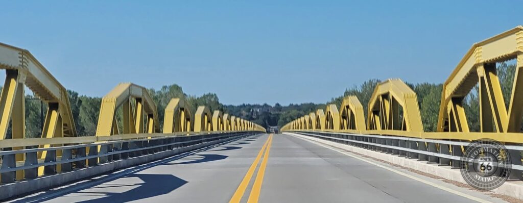
Beyond the bridge, travelers pass through a stillness where the old road reveals its original character with archaic slanted curbs along its edges that give a sense of what Route 66 looked like back in the day. The Main Street of America continues towards Weatherford where it follows I-40 but still finds its way to the center of small towns along the way. Clinton’s terrific Route 66 Museum enlivens appreciation for the old road’s storied history.
Texas
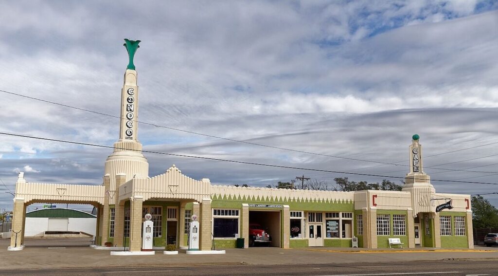
The 180-mile drive across the arid steppe of the Texas panhandle rolls along a broad flatland. Staying true to the Mother Road means shadowing the Interstate much of the way. The paralleling ride of old and new summons thoughts that the present cannot shake the past, which like a penumbra shadows our consciousness. Texas inadequately marks the way with historic Route 66 signs as if it seeks to ignore it. Yet, this indifferent expanse of the High Plains offers points of interest. In Shamrock, US Routes 83 and 66 intersect where Tower Station has been delightfully refurbished with old style Conoco gas pumps standing sentinel. The adjoining U Drop In once again dishes meals for trekkers. An old motel sits across the street for those who stay over in hopes of seeing a brilliant sunset that the Great Plains’ wide expanse so often showcases and a night view of the Tower Station’s wondrous neon that calls forth the ghosts of travelers’ past to fill ‘er up for the lonely road ahead.
Amarillo beckons, a town whose four-syllables rhythmically sing with vowels that found favor in Bobby Troup’s classic road tune. The Cadillac Ranch located nearby displays 12 aligned old Cadillacs, their front ends planted nose first on a 45-degree angle into the arid Texas earth. Graffitists worked nights to spray paint the Cadillacs with their trespassing art.
The owner acquiesced with a “can’t beat ‘em, join ‘em” sale of spray paint cans at $ 7.50 a pop for pseudo artists to exercise their whimsical color patterns that are destined to be re-covered ad infinitum with layers of spray paint by subsequent spraying artistes.
New Mexico
No town better depicts the old and current state of the Mother Road than Tucumcari, an old railroad town that grew larger because of its location at the crossroads of Routes 66 and 54. The town reflects the old road’s glory days juxtaposed with ghost town remnants. The town’s east end abuts an I-40 exit that boosts the town’s pulse, but farther west Route 66 contains boarded motels, gas stations and restaurants. But Tucumcari refuses to yield. A few Darwinian businesses survive, including the Safari and Road Runner motels and La Cita with its outsized sombrero sign beckoning travelers for good Mexican Food.
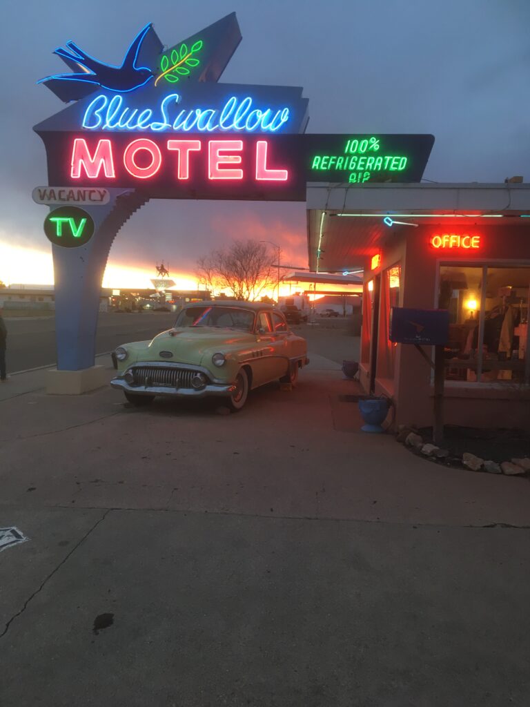
But the Blue Swallow Motel shines as the town’s brightest star bearing its neon name and bird in flight to entice travelers for a stayover in preserved Americana where a classic 1950 Fireball Eight stands a post out front. Opened in 1940, the motel retains its original aspect with rooms adorned with period lamps and chairs, an old-time radio, double-faucet hot/cold sinks, original tile floors and chenille bedspreads.
Dawn and Robert Frederico warmly greet travelers. Originally from the Mother Road’s leadoff city of Chicago, the voluble Mr. Frederico and his work-a-bee wife prefer to call themselves caretakers of this classic motel. The future of the past remains in good hands.
Past Santa Rosa, Highway 84 heads in a northwesterly direction to Santa Fe, with a road south down to Albuquerque via US 85 all the while remaining true to the Mother Road, as this roundabout way served as 66’s original pathway from 1926 to 1937. Highway contractors later constructed a straight line shot into Albuquerque thereby shaving off 197 miles of travel.
But the high road to Santa Fe offers better scenery and fascinating history. Pecos National Historical Park locates at the pass situated between the Sangre de Cristo mountains and flat-topped Glorieta Mesa. Ancestral Pecos people lived in the area for a millennia, later building the Pecos Pueblos around 1450. Spanish conquistadors developed a presence in 1598 where they built the Mission Nuestra Señora de Porciúncula. The clash between the Natives and Spanish and the remains of the pueblos and mission provide an historical perspective of the American Southwest.
Santa Fe’s art scene and its pueblo architectural style of earth-toned adobe exteriors with distinctive vigas and canales, and the Palace of Governors, Loretto Chapel and San Miguel Mission make this historic la ciudad a favored destination.
Beyond Albuquerque, 66 parallels I-40 until it pulls away for a serpentine path beyond the super slab’s visage where it edges by Owl Rock, and around Dead Man’s Curve to a lovely stretch of rocky cliffs that justify New Mexico’s appellation as the Land of Enchantment. The motorway rises to the continental divide where a small trading posts sits on the Pacific side of the nation’s watershed.
A gallop to Gallup follows, a town favored by bourgeois and motorcyclists alike for its watering holes, trading posts and art works. The town’s best attraction, the circa 1937 El Rancho Hotel, welcomes visitors with its sign ‘Charm of Yesterday, Convenience of Tomorrow’, which describes the structure of brick, stone and rough-hewn wood that house a commodious lobby flanked by twin stairways that lead upstairs to guestrooms adorned in southwest style.
Arizona
I-40 absorbed much of 66 in the state’s eastern end leaving remnant route pieces astride the interstate. The Painted Desert to the north and Petrified Forest to the south add to the Mother Road’s legendary status as the gateway to geographic wonders. Ahead looms Holbrook’s Wigwam Motel with its hard-sided faux tepees and weathered classic cars parked alongside.
Hop off the highway to the Jack Rabbit Trading Post, a surprisingly small place given its outsized status from days of yore. Its colorful jack rabbit ad board still announces: “Here It Is!” The storekeeper notes a drop in business due to a recent decline in foreign travelers, presumably for political reasons. Historically, half of 66’s visitors were Asians and Europeans.
The Main Street of American exits the interstate for a ‘taking it easy’ tour of Winslow and the lovingly restored La Posada Hotel, a former Harvey House built in 1928. A stroll through the hotel and its gardens, and especially the display of contemporary artist Tina Mion’s work—that includes inspired depictions of our presidents’ wives and the disquieting New Year’s Party in Purgatory for Suicides—makes this a must stop. Across the street, a 66-worthy Brown Mug Café serves homestyle Mexican meals at reasonable prices.
Route 66’s regains interstate independence approaching Flagstaff, a town with western architecture, crisp alpine air, the scent of ponderosa pines and a view of San Francisco Peak. Ten miles west, the old highway—some of it graveled—runs through an alpine forest. Next up Williams—the last stretch of ‘active’ 66 before completion of the final piece of interstate north of town—serves as a quaint tourist stop and the terminal for Grand Canyon Railway that takes visitors for to a two-hour ride up to perhaps our most famous national park.
Route 66 exits the interstate for a splendid two-lane 159-mile ride to the California line. Great places abound at Seligman, including the Supai motel and Roadkill Café. The approach to Peach Springs passes the restored Valentine Station. Stop at Hackberry for old gas pumps and classic cars slowly surrendering to rust. The road drops into Crozier Canyon with its wide-open spaces and craggy slants to Kingman where one can eat at Mr. D’Z’s Diner with its 1950s décor.
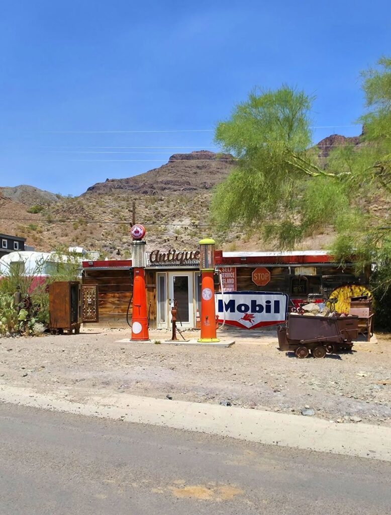
The historic highway crosses over the Sacramento Wash with a view of the Black Mountains to Sitgreaves Pass with 191 curves over the eight miles of up and over motor car fun—or fright—to reach Oatman. This old mining town with burrows roaming the dusty roads flanked by boardwalks with abutting wooden structures give it an old west feel.
California
The highway crosses the Colorado River to Needles where travelers hydrate and gas up before traversing the sunbaked Mojave Desert, an empty land flanked by railroad tracks. Eastbound trains pass five times per hour laden with intermodal trailers filled with imports destined for Amazon distribution centers for a consumer nation. We live in a far different world from Route 66’s heyday.
The Mother Road climbs the Cadiz summit with a viewing rest stop. Unfortunately, this long stretch of isolation has been bifurcated by bridge closures leaving place like Amboy, Roy’s Café, and Ludlow cutoff from thru traffic for much too long.
At Barstow, I-40 merges traffic to Interstate 15 for a high speed run to LA. Fortunately, Route 66 courses its own way for a quiet two-lane road to Oro Grande’s Bottle Tree Ranch, a bizarre place with metal ‘trees’ adorned with bottles interspaced with eclectic jumbles of junk. A ride over a modified Baltimore Truss bridge takes the driver to Victorville, and presentiment of an end of the open road.
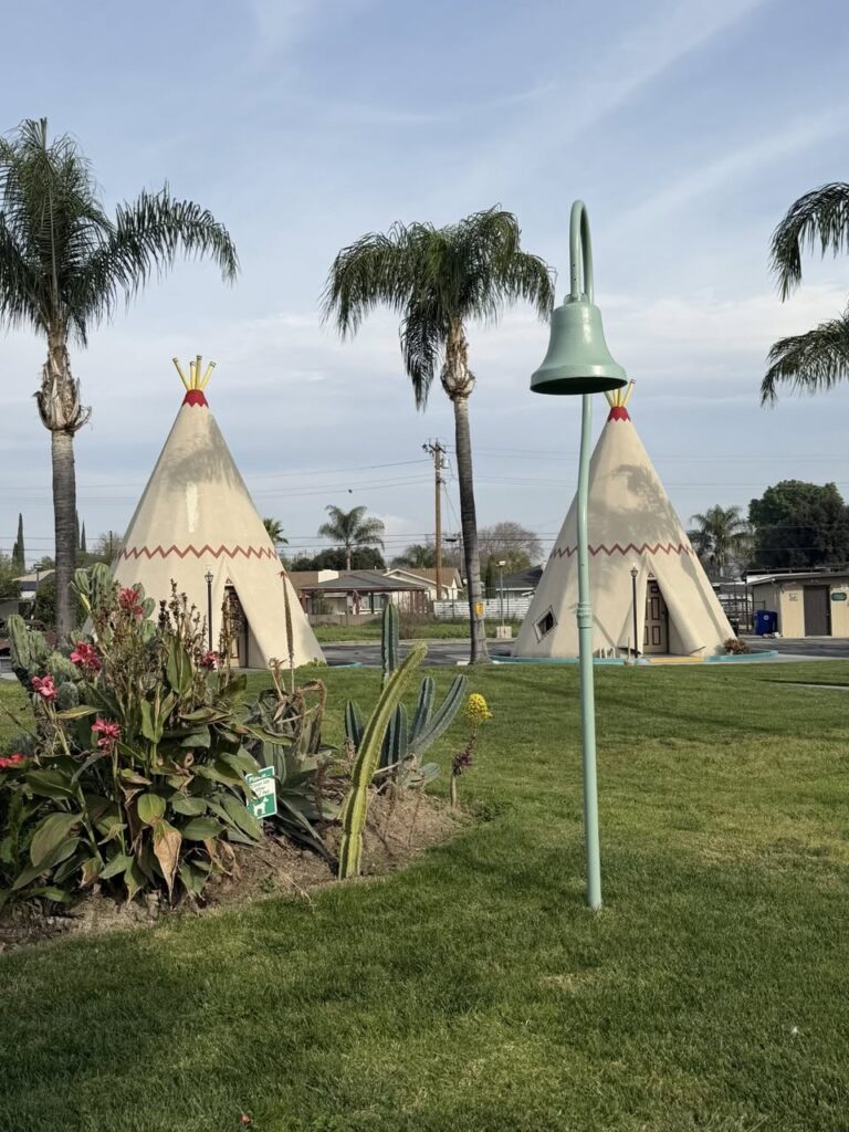
But an exit off the interstate near Cajon Pass provides one last section where 66 runs free along Cajon Creek. The Mother Road then runs along the northern end of Greater Los Angeles where old-style drive-up motels remain, especially the immaculately maintained Wigwam Hotel in Rialto, a Route 66 oasis from LA’s modern world. Only the dedicated stick to Route 66 beyond Pasadena with the patience of Job for a slog on a busy boulevard that bears little semblance to Route 66 of yore.
Many opt out and head for the freeway to the Santa Monica Pier on the Pacific Ocean shoreline. The Pier’s marker reads: “Santa Monica —66—the end of the trail.” But Route 66 never ends in the imagination of American roadsters. The Mother Road continues her journey through time and mind, providing a unique way to experience the historic, cultural and geographic wonders of America the Beautiful.
{comments appreciated}
11 replies on “Route 66’s Centennial of Americana and History”
testing
Wow! Dad, your words gave me an appreciation and a heightened interest in Route 66. It was indeed a different world when route 66 reigned supreme. Must have really been something all those years ago to head west via 66, and experience all the small towns, motels, diners and changing geography. However, as you so aptly put, there’s still plenty left worth for seeing and experiencing along the Mother Road.
Great article Paul! Very detailed description of one of the great pieces of our country’s not so long ago past.
Love the fact that you still enjoy and allow others to appreciate your research and provide an awesome element of US history. Thank you for reminding me that road trips in the USA are still one of the best ways to travel and see so many geographical and geological features we have all in the great USA!
thanks. had to self-publish…rejected by all possible tactile publications..even the Missouri Review, a misnomer for sure.
Another very good article. Paul’s experiences from driving the route from Chicago to California show in the depth of his writing. Educational and inspiring, makes one think about going on the road. Thanks!
Paul,
Great article, memories of 1970 driving down the two lane concrete highway with the up sloped shoulders near Devil’s Elbow all the while sucking in 95 degree air through the four rolled down windows on the way to Springfield. Thanks for the memories, John Z
you know it. hope all is well in FL. say hey to Jeannie
Paul, I have been waiting anxiously to read the piece while you were looking for a publisher. Well worth the wait. Not sure if I enjoyed the first half on the history of the route’s construction or the second half high-lighting remaining Americana treasures.
I laughed out loud at the description of Lester gill’s promotion of Meramec Caverns as Jesse James’ Hideout and how preposterous it would be considering its distance from Jesse’s normal stomping grounds. Loved “if his mouth’s moving, he is either lying or eating. But the description of countless painted barns certainly brought back youthful memories of family trips down into the Ozarks.
Couldn’t help but muse a bit sadly over Charles Kuralt’s observation that now we can travel all the way across the country and not see anything. At least we can see nothing faster.
Your piece reminds me of many trips with Dad, some just the two of us, many with the entire family, when we traveled mostly blue highways. It was very nostalgic.
Have to get together soon, so I can hear what are your favorite parts and sites.
PS, I got your route 66 post card. Your microscopic print really put my cataract repaired eyes to the test.
I heard the song (Get Your Kicks On) Route 66 in a store today. Having read this piece a couple days ago, I had a new appreciation for the lyrics and the significance route 66 had on the cities named!
thx. ’tis a great tune